Introduction
Rudgwick is easiest to misunderstand when approached as though it were one village. The modern built-up area now extends from Church Street towards Station Road and Bucks Green, but this apparent continuity is recent. For most of the parish’s history, fields, woods and wet clay separated several small communities, each with its own reason for being where it was. Church Street gathered people for worship and parish business. Bucks Green gathered roads. Wanford gathered carts at a river crossing and mill. Tisman’s Common developed beside common land. The Haven remained a farming country with its own mill and services. Rowhook belonged to the eastern through-routes, while Cox Green looked as naturally towards Ewhurst and Dunsfold as towards Rudgwick.
Those places were never isolated. A family from The Haven might take grain to Gibbons Mill, travel to Holy Trinity for baptism or burial, use Bucks Green for smithing and road traffic, and meet neighbours from Rowhook at a fair, school or vestry business. Yet the distances mattered. Before metalled roads, a journey of several miles over Weald Clay could be difficult in winter; even in the nineteenth century, children in the outlying districts needed local schoolrooms because the central route was too long for daily use. The history of Rudgwick is therefore not the history of one centre spreading steadily outwards. It is the history of several places, sometimes growing separately and sometimes drawn together by a new road, railway, school, estate or public institution.
The evidence is equally dispersed. Holy Trinity and the timber frames of old houses provide one chronology; manorial records, deeds and taxation supply another. Parish registers begin in 1558. Tithe maps and censuses place named households within the nineteenth-century landscape, while estate papers, school logbooks, railway records and local photographs become increasingly abundant thereafter. No single source tells the whole story. Read together, however, they reveal a parish whose physical form has changed greatly without losing the older pattern beneath it.
Where the places are
Holy Trinity stands near the northern end of Church Street on a ridge close to the old Sussex-Surrey boundary. From the church, Lynwick Street falls southwards to Bucks Green, where the present A281 meets roads from Loxwood, The Haven and Wanford. Wanford lies below and west of that junction, beside the River Arun. Naldretts Lane approaches it from the church-side country and passes Warhams, the earliest closely dated house in the parish.
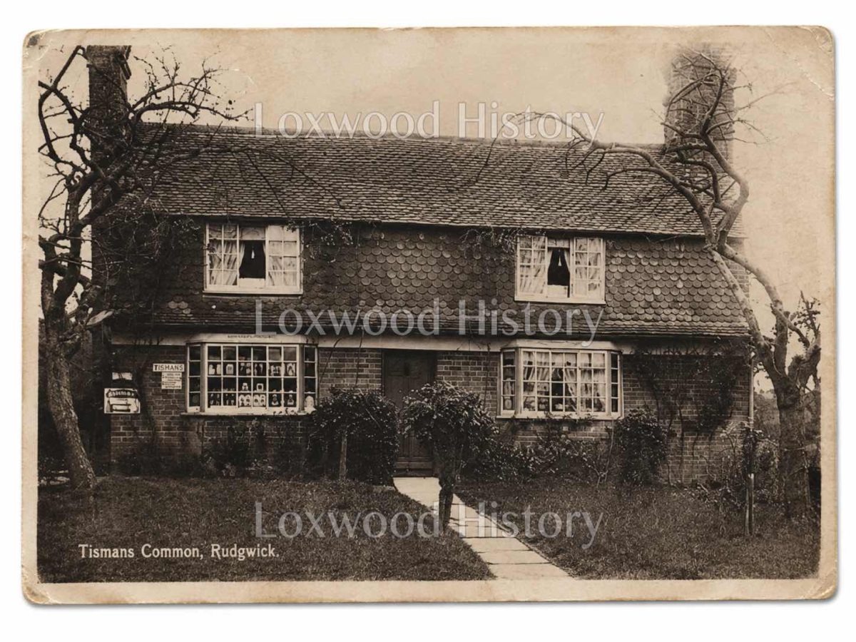
West of Church Street and Bucks Green lies Tisman’s Common, a loose sequence of farms, cottages and later houses extending towards Loxwood. South of Bucks Green is The Haven, an extensive rural district continuing towards Billingshurst; Gibbons Mill stands there on a smaller watercourse, well away from Wanford Mill. Rowhook occupies the eastern side of the parish around Honey Lane, the Chequers and roads towards Horsham, Ockley and the Surrey border. Cox Green lies to the north, historically divided from Rudgwick by the county line even though its roads and estates were closely connected with the parish. Station Road is the comparatively new element: a nineteenth-century line running south from the old church-centred settlement to the former railway station.
This geography is not background to the history. It is the history’s organising structure.
The wooded clay country before Rudgwick
Rudgwick has no separate entry in Domesday Book. That absence matters, but it does not leave the district empty in 1086. The later parish lay within a landscape already divided among estates whose principal centres stood elsewhere. Pulborough, Dedisham, Hope and Polingfold all acquired rights or holdings within the ground later recognised as Rudgwick; Polingfold, centred at Ewhurst in Surrey, reached so close to Holy Trinity that property beside the churchyard could be described as belonging to it. The parish boundary eventually gathered these pieces into one ecclesiastical territory without dissolving their separate rents, courts and customs. Pulborough’s Domesday entry is substantial, recording sixty-six households – thirty-eight villagers, nineteen cottagers and nine enslaved people – with eighteen ploughlands, thirty acres of meadow, woodland assessed for twenty-five swine, two mills, two fisheries and two churches. Its value was given as £23 15s in 1086, compared with £16 in 1066. Yet it does not describe Rudgwick. The later connection came through grants, landholding and patronage, particularly through the Fleming lords of Pulborough, who held the advowson of Holy Trinity. This distinction is essential: the documentary Rudgwick emerges after Domesday, from a territory whose older administrative attachments crossed what became the parish.
The later parish lay within West Easwrith Hundred in the northern part of the Rape of Arundel. An early nineteenth-century account called it a frontier parish and estimated at least 7,000 acres, about 4,000 of them cultivated; a later official calculation gave 5,960 acres. Such discrepancies belong to changing measurements and boundaries, but both descriptions emphasise scale. Rudgwick was a large tract of countryside before it was a recognisable village.
The physical landscape helps explain its dispersed form. Secure evidence for prehistoric settlement within Rudgwick itself is slight, although people moved through and used the wider Weald long before the parish existed. Weald Clay dominates much of the ground, broken by sandstone ridges, streams and the upper River Arun. Local sandstone and the roofing stone commonly called Horsham slate occurred near the ridge. Low-lying routes could become deeply rutted and waterlogged, while higher ground offered firmer passage. A farmhouse established within an assart – a clearing taken from woodland or waste – might stand in its own closes, with hedges, pasture, woods and streams separating it from the next holding. Rudgwick never acquired the great open-field pattern that drew many Midland populations into compact villages. Before permanent farms spread across the clay, the Weald was used from older settlements to the south for seasonal grazing, timber and woodland produce. Place-names preserve part of that earlier economy. Two fields at Tisman’s Common were known as the Denns, a name associated with woodland pasture, and Hoglands in The Haven retained a connection with swine. Such names do not by themselves reconstruct a Saxon settlement, but they belong to a wider pattern of animals driven into the Weald for mast and grazing, along tracks that later generations adapted for farms and local travel.
The eastern side carried older long-distance movement. Stane Street, the Roman road from Chichester to London, passes through neighbouring Slinfold, and an early route in the Rowhook district continued towards the Surrey Weald and the Roman religious site at Farley Heath. Excavated road material near Roman Gate and the relationship with Stane Street provide firmer evidence for movement than any claim for a Roman settlement in Rudgwick. This does not make Rudgwick a Roman village. It shows that the eastern ridge lay beside a corridor of travel long before Honey Lane, the Chequers or the turnpikes gave Rowhook its later character.
Permanent settlement increased through clearance in the eleventh, twelfth and thirteenth centuries. Roads grew from repeated journeys: to a holding, a woodland edge, a ford, a mill or a neighbouring parish. Their bends were practical. On heavy clay, the shortest line was not always the quickest, and a route that kept to firmer ground could be preferable to a direct descent through a wet hollow. The crooked lanes of Rudgwick are therefore evidence of adaptation rather than disorder.
By the opening of the thirteenth century, the district contained a network of farms and tenements answerable to several manors. Drungewick or Bradbridge, South Stoke, Parham, Bignor and Storrington occur among the wider fees connected with land in the parish; some property owed quit-rents and heriots to Denne in Warnham. Hounsil Farm, about ninety-four acres in an early nineteenth-century account, was held under the Dean and Chapter of Chichester. What the district still lacked was a single name and institution capable of binding these different tenures together. That changed on the ridge.
A church on the ridge and a parish of farmsteads, 1210-1400
The name Regwick occurs in 1210 and has long been interpreted as a farm or settlement on a ridge. The description suits the high ground occupied by Holy Trinity and the oldest part of Church Street. It should not be imagined as a medieval village street lined with houses. The ridge was first a named and sacred centre within a much larger countryside of separate holdings. Holy Trinity contains early thirteenth-century fabric, most conspicuously in its broad western tower. The vicarage existed before 1272, while later records distinguish the rectorial property beside the church from the vicarage farther down the route that became Lynwick Street. The distinction mattered. The rectory carried land and income; the vicar served the local cure. Both belonged to the ecclesiastical structure of Rudgwick, but their property and obligations could follow different histories.
A medieval parish church was more than a Sunday meeting room. Across England it was the place where the population encountered the principal rites of Christian life: baptism at the font, Mass at the altar, marriage, confession, communion and burial. The chancel belonged chiefly to the clergy and the celebration of the offices and Mass; the nave accommodated the laity. Bells marked worship and public occasions. The churchyard received most burials. For Rudgwick this general pattern has a particular geographical significance, because the congregation did not live around one square. Holy Trinity repeatedly drew households uphill from Bucks Green and Wanford, westwards from Tisman’s Common, northwards from The Haven and across the eastern lanes from Rowhook.
The annual calendar gave those journeys a rhythm. Sundays and major feasts brought regular attendance; Lent and Easter imposed their own obligations, and the dedication of the parish church gave Rudgwick a local festival. In 1260 Henry III granted Alard le Fleming, lord of Pulborough and holder of the advowson, a fair on the vigil, feast and morrow of Holy Trinity. Walter de Lisle and Florence, one of the Fleming heiresses, held it in 1279. For three days the ridge became both sacred and commercial ground, with the church feast and temporary standings occupying the same small centre. The fair did not turn Rudgwick into a market town. Its importance lay precisely in its periodic character. A parish normally spread through fields and woods gathered at the church for worship, trade and sociability, then dispersed again along the same lanes. Centuries later a lease of 1733 still referred to a Fair Hovell and the right to erect standings beside the property that became the King’s Head. The survival of that practical arrangement shows how deeply the medieval feast was embedded in the place.
Warhams, in Naldretts Lane west of the ridge, supplies another kind of evidence. Tree-ring dating places its earliest phase between 1213 and 1239. It began as a substantial double-aisled timber hall, with great internal posts carrying a wide roof over the central space. Local tradition has sometimes connected the house with Alard le Fleming, but the secure evidence is the timber date and the building itself. This was not a cottage added beside Holy Trinity. It stood within an agricultural holding on the route towards Wanford and the Arun, demonstrating that important domestic occupation was already established outside the church-side group during the first half of the thirteenth century.
The parish was therefore one in worship before it was one in settlement form. A household might hold land from Dedisham, Hope or Polingfold, use a mill reached by another route and cross into Surrey for work or marriage, yet still belong to Holy Trinity for parochial rites and burial. Rudgwick lay in the Diocese of Chichester; nearby communities across the northern boundary belonged to Winchester. Ordinary movement ignored that border more easily than ecclesiastical jurisdiction did. Water created further centres. A record of 1318 refers to land beside Wanford water between the bridge and property associated with the Naldrett name. The wording places a recognised crossing and landholding at the Arun long before the detailed mill leases of later centuries. Farther south, Gibbons Mill developed on a separate watercourse in The Haven. The two sites should not be merged: Wanford belonged to the river crossing below Bucks Green; Gibbons belonged to the southern farm country.
A Dedisham custumal of 1321 names Alan atte Rugge holding a messuage and a virgate for customary service. His entry gives a human scale to the overlapping jurisdictions. He lived within the parish of Rudgwick, but the land was answerable to a manor centred outside it. Parish and manor were not rival maps. They described different obligations laid over the same ground. Holy Trinity was enlarged during the early fourteenth century. The chancel and north aisle belong principally to this phase, with their arcade and window tracery increasing the capacity and dignity of the building. Such work is difficult to reconcile with an image of a parish without resources or organisation. It represents collective and institutional investment at the very place where a scattered population met.
The Nonae taxation of 1341 nevertheless gives Rudgwick a distinctly agricultural character. The return reported no major resident estates or merchants and stated that the parishioners lived from the land by their own labour. A local transcription also records about 300 acres formerly cultivated but then lying untilled. The words should not be made to say more than they do: Rudgwick was not necessarily destitute, and its surviving houses contradict any simple picture of universal poverty. What the return does show is the absence of a resident magnate or urban trading class and the centrality of small and medium agricultural holdings.
The buildings confirm that those holdings were distributed through separate districts. Snoxalls at Bucks Green was built in 1337-38; Hoglands in The Haven in 1369-70; Swains Cottage at Tisman’s Common in 1378-79. Woes, facing Holy Trinity, also contains medieval open-hall fabric. Within little more than forty years, substantial timber houses appeared at the road junction, in the southern farm country, on the western common and beside the church. Their distribution is the clearest possible warning against treating medieval Rudgwick as a single village. Inside such houses the hall rose open to the roof, with smoke from a central hearth passing into the upper space before escaping through the roof covering or a louvre. Service rooms lay beyond a cross-passage; a more private end could contain a chamber. Later generations inserted floors and chimney stacks, but the medieval frames survived inside altered homes. The 1996 parish survey identified thirty-three open-hall houses across Rudgwick. The landscape and the buildings tell the same story: settlement was widespread, durable and tied to individual holdings.
Watermills formed part of the same farming economy. Local research has used the 1341 material as the earliest evidence for two mills, although the document does not securely identify Wanford and Gibbons by name. Their later documentary and physical sequences are consistent with long use. The uncertainty is worth preserving, because it separates what the taxation proves from what later history strongly suggests.
Holy Trinity, the fair and the late-medieval communities, 1400-1548
By the fifteenth century the names of farms and families become more frequent in deeds. In 1455 the son and heir of John Puttock released rights in Naldretts to Thomas Warnham, fixing Naldretts as a recognised property name before the family later associated with the district became prominent in the surviving record. Similar transactions carried land, woodland, rent and inheritance from one generation to another while the underlying manorial obligations continued. House building also makes the geography more legible. Burnalls Cottage strengthened the older settlement at Bucks Green. Two Wells stood in Church Street. Gibbons Mill House contained early-fifteenth-century fabric in The Haven, while Exfold belonged to Tisman’s Common. Canfields was established on Lynwick Street around the middle of the century, and Honey Lane Farmhouse occupied the eastern ridge later in the period. By 1500 every principal district contained long-established holdings, but fields, orchards and woods still separated them.
Church Street remained the smallest and most specialised of those centres. Holy Trinity, the parsonage, a few houses and the lane towards the vicarage stood on the ridge. Most of the later historic frontage developed on the western side of the road. Rectorial and glebe land kept much of the eastern side open, a difference still visible in the later age of development there. The term ‘street’ should not mislead: Lynwick Street, too, was for most of its history a country lane passing spaced houses, yards and fields as it descended towards Bucks Green.
In 1445 the rectorial income of Rudgwick was annexed to the chantry founded by Thomas Salmon at the collegiate church of Arundel, and William Baynton was presented in that year. The great tithes and rectorial estate now supported a religious foundation many miles to the south, while the vicar continued the cure of souls at Rudgwick. Grain, livestock and rent from the Low Weald were thus drawn into a devotional economy whose purpose was the maintenance of worship and intercession elsewhere. The arrangement belongs to the religious world reconstructed in broader studies of medieval parish life. Churches contained more than bare walls and a single altar. Lights, images, textiles, plate, books and painted or glazed imagery gave material form to the calendar of worship. At Rudgwick the evidence is fragmentary: nineteenth-century observers recorded remnants of richly coloured medieval glass and three stone seats in the chancel, but no complete medieval inventory has been preserved in the reviewed material. The surviving pieces should therefore be valued without being expanded into an imaginary reconstruction.
What can be said securely is that Holy Trinity remained the fixed destination of a dispersed parish. The chancel housed the principal altar and clergy; the nave received the congregation; the churchyard held the dead of Bucks Green, Tisman’s Common, The Haven, Rowhook, Wanford and the scattered farms. Feast days and the Trinity fair made the ridge temporarily crowded, but the church’s deeper importance lay in repetition. Week after week, and at the turning points of individual lives, the roads converged there.
The separation between the districts nevertheless endured. Bucks Green was already a road place, with Snoxalls and Burnalls near converging lanes. Wanford was a water place, organised by bridge and mill. Tisman’s Common remained a western farming and common-edge district. The Haven was a southern landscape of farms and Gibbons Mill. Rowhook belonged to roads and to the Dedisham estate on the eastern side. Holy Trinity united them sacramentally and administratively; it did not erase their local character. The late-medieval rectory arrangement ended abruptly in the sixteenth century. The Salmon Chantry was suppressed in 1548, and the annexation of Rudgwick’s rectorial income came to an end. A lease of the former impropriation was made to Thomas Wiseman in 1554. The vicarage survived, but the institutional world around it had been transformed.
Reformation, iron and changing houses, 1548-1700
The Reformation reached Rudgwick through property, worship and record-keeping. The suppression of the chantry removed the external institution that had received the rectorial income. Successive royal settlements altered the liturgy of Holy Trinity and the religious objects regarded as lawful within it. Under Edward VI, chantries, images, side altars, lights and prayers for the dead were attacked across England; Catholic rites returned under Mary, only to be replaced again by the Elizabethan settlement. The changes were national, but their effects were worked out parish by parish, through clergy, churchwardens, inventories, sales and the refashioning of buildings. Sussex evidence shows how unevenly that process could proceed. Wills made into the 1540s still requested burial beside particular images or altars and paid for priests to sing Masses. The royal visitation of 1547 ordered the removal of images associated with pilgrimage and offerings; at Bolney, churchwardens later sold altar cloths, vestments, a cope, a pyx and other fittings, while the roodloft at Lindfield survived until 1583. These examples do not prove that Rudgwick followed the same timetable. They establish the diocesan world in which Holy Trinity was being altered.
The local evidence needs disciplined handling. No surviving Rudgwick account reviewed for this article lists every object removed from Holy Trinity. The secure chronology is narrower: the Salmon Chantry connection ended in 1548; Crown arrangements followed; the parish registers begin in 1558; and fragments of medieval glass and chancel seating survived to be described centuries later. Those facts show institutional disruption and material survival together. They do not justify pretending that Rudgwick either accepted or resisted each reform in a uniform way.
The register transformed what can be known about the parish. Baptisms, marriages and burials placed family names within a continuous local sequence, complementing the scattered evidence of deeds and manorial courts. An entry of 1564 records the baptism of Richard, son of William Naldrett. The name could now be followed not only through land at Wanford and Naldretts but through the rites performed at Holy Trinity. Parish identity became more visible on paper at the very moment when its older religious forms were being recast.
Elsewhere in the parish, economic change was equally tangible. Dedisham, centred across the eastern side towards Slinfold and Rowhook, developed a furnace and forge during the Elizabethan period. Ironstone, water power and coppiced woodland made the district suitable for Wealden ironworking. Ore had to be dug and carted; charcoal burners converted repeated crops of wood into fuel; water drove bellows and hammers; finished iron travelled out along the same roads that served farms and neighbouring markets. Dedisham did not turn the whole parish into an industrial settlement. Its influence was strongest in the east, around Furnace House, Rowhook and the roads towards Slinfold. The Haven remained predominantly agricultural, though woodland work and Gibbons Mill diversified its economy. Bucks Green and Wanford were drawn towards milling, carting and smithing. Tisman’s Common combined farms with smaller common-edge holdings. The industries overlapped, but their locations remained distinct.
Ownership of Dedisham changed repeatedly. The estate had passed to the Lewknor heirs by 1530 and was granted by Edward VI to Sir Richard Blount in 1547; it later moved from the Blount family to the Onslows around 1630. Hope continued to include tenements in Rudgwick, while Bassetts Fee and other holdings crossed several neighbouring parishes. These descents make the legal map look intricate because it was intricate. Parish unity did not simplify landownership.
Domestic buildings record another revolution, quieter than the Reformation yet almost as far-reaching in daily life. The open hall had placed the household around an unconfined hearth beneath the roof. During the sixteenth and seventeenth centuries, smoke bays and brick chimneys increasingly enclosed the fire. Floors could then be inserted across the former hall, creating chambers above and more specialised rooms below. Warmth, privacy and the organisation of work changed within the old frame. The transformation was gradual. One house received a narrow timber smoke bay; another acquired a brick stack; a third was built from the outset with two storeys and a chimney. More than forty smoke-bay and chimney houses of the sixteenth and seventeenth centuries were later identified in Rudgwick. Their distribution once again follows the separate settlements. Hencocks and Cousens belong to the growing western frontage of Church Street. Martins on Lynwick Street contains reused timbers. View Tree Cottage and Morgans Green Cottage stand in The Haven. Tisman’s Common contains a particularly dense group of smaller houses associated with roadside and common-edge plots.
This was expansion, but not urbanisation. Houses gathered at selected points while fields remained between the main communities. Church Street gained density on its western side; the eastern glebe stayed largely open. Tisman’s Common acquired cottages without becoming a continuous street. In The Haven, farmhouses and smaller dwellings stood among woods, yards and closes. Rowhook grew along several roads rather than around a planned centre.
Parish government operated alongside the old manorial framework. Churchwardens and vestry dealt with Holy Trinity, local rates, poor relief and practical obligations. Manorial courts continued to regulate rents, heriots, inheritance and tenures belonging to Dedisham, Hope, Polingfold and other estates. A family could therefore appear in the register at baptism, in vestry material through a rate or relief payment, and in a court record as tenant of land whose lordship lay outside Rudgwick. The Naldrett family illustrates how property could connect those worlds. A Chancery suit of 1601 refers to John Naldrett of Wanford and to the estate of his father Richard, who had died in 1595. George Naldrett of Naldrett Place died in 1646. Through marriage, inheritance, mortgages and lending, later generations linked Naldretts, Wanford and property beyond the parish. The family did not rule Rudgwick as resident lords of a single manor; its importance came from the accumulation and management of land within a much more fragmented territorial system.
The roads themselves enter clearer evidence towards the end of the century. John Ogilby’s surveyed route of 1675 passed through the Rowhook and Honey Lane district and showed alternative branches across the Weald. Such alternatives were not cartographic indecision. Rain could make a lower line nearly unusable, while a longer route on firmer ground remained passable. Rowhook’s later combination of inn, smithy and road services grew from this geography of choice and difficulty. Bowcroft Lane belonged to the older approach towards Horsham from the central parish. It too would lose status when nineteenth-century engineers selected a more direct turnpike line. Yet loss of through traffic did not mean disappearance. Like many Rudgwick lanes, it continued because farms and field entrances still required it.
By 1700 Holy Trinity, parish government and the register bound Rudgwick together more visibly than before, but the parish still had no single economic centre. The ridge, road junction, river crossing, common, southern farms and eastern routes each supported a different cluster of work and habitation. That diversity became even clearer in the eighteenth century.
Mills, inns and the several centres of the eighteenth century
Wanford Mill was one of the largest working sites in eighteenth-century Rudgwick. A lease of 1718 described three water mills containing four pairs of millstones, together with the mill house, watercourses, ponds and bays. Whatever the precise arrangement of wheels and gearing, this was not a minor farm appliance. It was a substantial installation serving a wide agricultural district. Its position explains the traffic. Wanford stood where the River Arun and a separate millstream required bridges, channels and controlled water levels. Grain arrived from farms in Rudgwick and neighbouring parishes; flour and meal left by the same roads. Millwrights, carpenters and smiths were needed to maintain machinery, carts and ironwork. The approaches from Naldretts Lane, Bucks Green and The Haven converged on a crossing that had been important long before the surviving lease was written.
The Allberry family became associated with Wanford from the 1720s, combining milling with farming and later property interests around Bucks Green. This combination was characteristic. A rural mill required land, stables, storage and carts as well as machinery; the miller was often also a farmer. Profits from grinding could be invested in cottages, shops or fields, extending the influence of the mill household beyond the watercourse. Gibbons Mill must be kept separate in both geography and history. It stood in The Haven on a smaller southern stream, among farms and meadows rather than at the main Arun crossing. Mill Farm and the mill business did not always have the same occupier, and records use several spellings of the Gibbons name. The watercourse and the surviving complex supply the continuity. Wanford organised movement below Bucks Green; Gibbons organised a different network within The Haven.
An 1801 parish return recorded two watermills and one windmill, with a combined capacity stated as six loads in twenty-four hours, confirming that different sources of power operated at the same time. The two watermills have been identified locally with Wanford and Gibbons, although the 1341 taxation does not securely name either site. The windmill recorded in 1801 is less certain because more than one ridge site is known across the wider period. By the nineteenth century a post mill at Snell Farm gave Rowhook its own grain-processing centre on the exposed eastern high ground.
Property and credit also shaped the eighteenth-century parish. George Naldrett served as Sheriff of Sussex in 1746 and died unmarried in 1778, aged seventy-one. Litigation followed, and James Piggott was confirmed in possession in 1780. The Naldrett inheritance linked Wanford, Naldrett Place and other holdings through family connections rather than through a manor called Rudgwick. The Nappers and Butchers likewise appear among the yeomen and lenders whose money circulated within the farming economy. In the parliamentary poll of 1734, thirty-two Rudgwick freeholders recorded votes, a useful measure of qualifying property ownership.
Church Street acquired a different kind of permanence. The 1733 lease of the property later known as the King’s Head mentioned a messuage, a Fair Hovell and the right to erect temporary standings. The medieval Trinity fair therefore remained attached to a specific piece of village property. By the later eighteenth century the King’s Head served licensed trade beside the churchyard and also accommodated parish business; vestry proceedings could move from the church to its rooms without leaving the ridge-top centre. A wall painting dated 1770 commemorated the first peal rung at Holy Trinity. It remained in the inn until alterations in 1924, when it was removed and later transferred to the Sussex Archaeological Society. The object united bell-ringing, inn culture and parish memory in a single piece of painted plaster. It is exactly the kind of survival that gives local history its texture.
The other licensed houses belonged to other settlements. The Queen’s Head was built at Bucks Green around 1760 and was an inn by 1796, serving a junction already busy with farm traffic and the route to Wanford. At Rowhook, a building associated with smithing became the Chequers around 1798, combining road service with refreshment and stabling. Neither inn was an outpost of Church Street. Each grew from the needs of its own road district.
Shops and workshops were similarly distributed. The Old Bakehouse in Church Street was associated with tailoring and mercery; an account book later found in the building recorded garments made for private customers and for parishioners receiving poor relief. Butchers, carpenters, wheelwrights, weavers and small retailers worked from houses or adjoining workshops. At Bucks Green, smithing and wheel repair served mill and road traffic. At Rowhook, the smithy answered both farm and long-distance needs. The 1777 map by Andrews and Drury makes the parish intelligible as a network. Church Street occupies the ridge; routes descend to Bucks Green and The Haven, turn west towards Tisman’s Common and Loxwood, and run east towards Rowhook and Horsham. The map contains inaccuracies, but its larger pattern agrees with later evidence. The settlements are connected, not merged.
Samuel Hieronymus Grimm’s watercolour of about 1790 catches Holy Trinity before Victorian restoration. The low western tower with its pyramidal roof, the south porch and the former west porch stand within an open churchyard. Fields and glebe approach closely. The image does not show a dense village because none existed. Church Street was a small parish centre surrounded by an agricultural landscape. Recreation occupied temporary ground in the same way as trade. Cricket was played in the wider district by the eighteenth century, and later Rudgwick clubs depended on farm or estate fields rather than a permanent public ground. The Trinity fair, matches, inn gatherings and church occasions all made intensive use of places whose ordinary function was agricultural or domestic.
Holy Trinity, about 1790, by Samuel Hieronymus Grimm. The view shows the former west porch and the open ridge-top setting before Victorian restoration.
Dedisham remained a substantial eastern estate and passed from the Onslow family to the Duke of Norfolk in 1786. The transfer changed ownership but not the roads, farms or tenancies through which the estate operated. This was typical of Rudgwick: title could move considerably while the physical framework remained stubbornly local.
Turnpikes, enclosure and the mapped parish, 1800-1865
The first national census counted 760 inhabitants in Rudgwick in 1801. There were 837 in 1811, 974 in 1821 and 950 in 1831. The 1801 return also recorded 118 inhabited houses, rising to 126 in 1811. Those figures describe a population spread over nearly six thousand acres, not a compact settlement concentrated around Holy Trinity.
The opening decades of the nineteenth century changed the connections between the small centres. The Horsham-Guildford turnpike was authorised in 1809 and completed through Rudgwick around 1810. Its line forms the modern A281. It did not create Bucks Green. Snoxalls, Burnalls, Forge Cottage and the lanes from Lynwick Street, Loxwood, The Haven and Wanford were already there. The turnpike selected that existing junction and carried a more direct east-west road through it. A tollhouse and gate stood near the Haven Road turning. Other gates on the division included Wildwood, Roman Gate and Strood. Toll income paid for surveyors, gatekeepers, stone, drainage, bridges and repair. For residents, the road offered a better surface and more reliable long-distance travel; for Bucks Green, it brought coaches, commercial carts and passing horses into a place already equipped with an inn, smithy and routes to the mill.
Bowcroft Lane lost much of its former through traffic towards Horsham, though it continued to serve local holdings. Rowhook acquired turnpike improvements towards Ockley and, around 1830, towards Ellens Green and Slaughterford Bridge. The eastern district consequently developed a hierarchy of routes: new engineered roads for heavier traffic, older lanes for farms and local journeys, and green tracks that gradually lost wheeled use.
Tisman’s Common changed for a different reason. Parts of the common were divided during the Napoleonic period, and the remaining Exfold Wood Common and Greenhurst land were enclosed in 1854. Surveyed plots, hedges and ditches replaced open or shared margins. Swains Cottage and the older farms did not move, but their relationship with the surrounding ground altered. Later cottages, horticultural plots and the Cricketers fitted themselves into the new boundaries. Enclosure did not make Tisman’s Common look like Bucks Green. The latter was a concentrated road junction crossed by the turnpike; Tisman’s remained a looser western settlement stretched along several lanes. Its identity came from common-edge occupation, farms such as Tisman’s, Hornshill, Hale, Exfold and Motts, and the smaller trades needed by that district.
Church Street acquired institutions rather than a large new population. A permanent Congregational chapel was built in 1823-24, adding a Nonconformist place of worship near the Anglican centre. Kings was remodelled around 1812 and later served as a private school before acquiring medical uses. At Franktonhook, part of the property later associated with the Fox served as the parish workhouse until 1844. Poor relief, worship and schooling were beginning to occupy recognisable buildings, but they were not all placed in one centre.
The older ecclesiastical property remained surprisingly substantial. In 1809 the impropriate manor and rectorial tithes were sold to the Duke of Norfolk under land-tax redemption arrangements, while the advowson of the vicarage was reserved. A county account of 1835 described the rectorial estate as including fifty-three acres of tillage, ten acres of woodland, quit-rents, suit of court and two watermills. Medieval distinctions between rectory and vicarage still shaped property in the same year that turnpike engineering represented a new age of administration. The 1835 account also recorded Holy Trinity before its principal Victorian restorations. The nave and north aisle were divided by a pointed arcade; the western tower remained dominant; medieval glass survived in fragments; and three stone seats stood in the chancel beneath rounded arches. A table tomb appeared never to have received an inscription. Memorials included Humphry Crawley and George Naldrett. The parish register beginning in 1558 was still accessible to the antiquary who described them.
The tithe survey of the 1840s supplies the first detailed map against which household evidence can be set. It shows Church Street as the church, inn, shop and rectorial centre; Lynwick Street as the descending link to Bucks Green; Bucks Green as the turnpike junction; Wanford as the mill and river crossing; Tisman’s Common as farms and cottages around former common land; The Haven as scattered holdings and Gibbons Mill; and Rowhook as an eastern road-and-farm district. Consecutive census entries can look deceptively close on paper. On the map, some were separated by fields, woods and several bends of a lane.
The 1841 census counted 950 inhabitants. Ruth Puttock, aged forty, was recorded as a schoolmistress in Church Street. Richard Etherton, a hoop-bender, lived at Swains Cottage on Tisman’s Common. Farmers shared their houses with spouses, children, relatives and resident servants; labourers occupied smaller cottages near the holdings where work was available. Dressmaking, carpentry, blacksmithing, shopkeeping and domestic service sat beside agriculture, but their distribution followed the settlements. By 1851 the population had risen to 1,097. Bucks Green contained an unusually concentrated mixture of occupations. George King kept the Queen’s Head and worked as a millwright; James Stanford at Snoxalls was a wheelwright; John Allberry at Burnalls combined farming with grocery trade; Henry Allberry at Wanford Mill was a miller and farmer. Within a short distance, the turnpike, inn, smithy, farms and mill road supported one another.
Tisman’s Common was more spread out. Its named farms employed labourers and servants, while a smithy served agricultural and road work. In The Haven, Gibbons Mill operated among Hoglands, Shortloes and other farms. Rowhook contained the Chequers, Snell Farm, Monks and Furnace House, linking agriculture with road traffic and the memory of ironworking. Lynwick Street connected Church Street and Bucks Green through Canfields, the Old Vicarage and other spaced properties. The census reveals one parish; the map reveals several communities. The household schedules contain more than occupations. A large farm could include the farmer’s spouse and children, unmarried relatives, indoor servants and agricultural servants living under the same roof. Labouring families occupied smaller cottages. Widows sometimes headed households; apprentices and lodgers appeared among village trades; public houses combined commercial rooms with family accommodation. Ten years later, the same building might contain a different mixture as a tenancy changed or children entered work.
School provision made the distances impossible to ignore. A schoolroom opened at Rowhook in 1856, followed by one in The Haven in 1862 with accommodation for about sixty children. James Braby of Maybanks financed a Church Street schoolroom in 1863, later known as Jubilee Hall. A schoolroom at Ellens Green, across the Surrey boundary, served northern households. These small institutions existed because a child from an outlying farm could not easily walk to Church Street and back over winter roads.
Holy Trinity underwent restoration between 1843 and 1847, while Rudgwick Chapel reopened in 1853 after a period of closure. Licensed trade also expanded under nineteenth-century beerhouse legislation. The Plough occupied cottages in Church Street. The Pig served Tisman’s Common before the Cricketers opened nearby in 1855. The Blue Ship entered licensed use in The Haven, and the Fox developed at Franktonhook from the property associated with the former workhouse. The licensed map of Rudgwick was also a settlement map. A directory of 1859 makes that map personal. Henry Allberry was at Wanford Mill, William Botting at Gibbons Mill and James Chandler at Snells. Charles Sendall kept the King’s Head and worked as a butcher; Alfred Churchill kept the Queen’s Head; Levi Port the Chequers; Edward Songhurst the Cricketers. Farmers, millers, builders, wheelwrights, timber merchants and shopkeepers were not gathered in a single commercial centre. They occupied the places whose traffic and resources sustained them.
By 1861 the population stood at 1,068. Across fields south of Church Street, surveyors and contractors were already imposing a line unlike any road that had preceded it.
Railway, schools and Victorian growth, 1865-1900
The Horsham and Guildford Direct Railway cut across Rudgwick on an engineered geometry that ignored the patient curves of the old lanes. Parliamentary authority had been obtained in 1860. Local promotion was associated with James Braby of Maybanks, Thomas Child of Slinfold and the contractor William McCormick. Embankments, cuttings and bridges crossed agricultural land south of the church settlement before the line continued towards Baynards and its tunnel. Trains began running between Horsham and Guildford on 2 October 1865, but Rudgwick station did not open with the line. The proposed platform lay on a gradient of 1 in 80, too steep for passenger use in the judgement of the Board of Trade. Further work reduced the gradient to about 1 in 130, and the station opened on 1 November. The delay left a conspicuous physical result: raised approaches and additional engineering fixed the station on open ground beyond the old village.
A new road ran northwards from the platform to Church Street. Station Road was not an ancient lane improved for modern traffic; it was a direct route created because the railway needed an approach. The Railway and Commercial Inn, later the Martlet Hotel, stood beside it with parlours, bedrooms, stabling and coach accommodation. Sidings and a goods yard received coal, parcels and agricultural supplies and sent farm produce outward. Railway cottages, villas, shops and services gradually followed. The railway did not make the older geography obsolete. It depended on it. Coal unloaded at the goods yard travelled by cart along Church Street, Lynwick Street, Haven Road and Loxwood Road. Produce came in from Tisman’s Common, The Haven, Rowhook and Naldretts Lane. Local carriers and George Standing’s horse-drawn fly connected the station with farms beyond easy walking distance. The line created a national connection; the lanes gathered the traffic that sustained it.
Sunday-school excursions reveal a less commercial consequence. Children who had known the parish through long walks over clay roads could now travel by train to Littlehampton or Bognor. The outing was temporary, but the change in scale was profound. Rudgwick remained rural while its inhabitants acquired direct access to towns, the coast and wider markets.
The turnpike declined as the railway prospered. Toll gates on the Horsham-Guildford road were opened in 1873. Responsibility for former turnpike sections passed increasingly to parish and highway authorities, whose minutes recorded the cost of stone, bridge repairs and traffic arriving from Loxwood, Kirdford, Alfold and neighbouring districts on its way to the station. Farnham gravel was ordered in the 1880s. A road once financed by passing tolls had become a shared public burden.
Education was reorganised just as decisively. A pair of cottages in Lynwick Street was adapted as a school in 1875, with other cottages providing a master’s house. The arrangement was short-lived and cramped. Rudgwick entered the School Board system in 1877; Charles Woods became headmaster; and a purpose-built school opened at Bucks Green in 1880. By 1891 it had accommodation for 150 boys and girls, 160 names on the books and an average attendance of 124. Bucks Green was a logical site, but not a universally convenient one. It stood at the road junction between Church Street, Loxwood Road, Haven Road and the approaches to Wanford. Children could reach it from several directions, and the building joined the Queen’s Head, smithy, shops and older farms as another public function of the hamlet. For pupils in Rowhook or the far south of The Haven, however, the journey remained long. The smaller district schoolrooms consequently continued for a time alongside the Board School.
School attendance followed the agricultural and physical landscape. Harvest work, livestock, illness, heavy rain and winter mud reduced numbers. The school year retained harvest holidays, while inspection and the standards system imposed a more regular curriculum of reading, writing and arithmetic. The tension between national expectations and local working life appears repeatedly in the logbooks. Education was becoming compulsory; distance and farm labour had not ceased to matter. The Church Street schoolroom acquired a new role. In 1897 it was presented for parish use as Jubilee Hall, giving the ridge-top settlement a permanent meeting place beside the church, inn and shops. A building first created for children became part of the civic life of adults, another example of Rudgwick adapting rather than replacing its structures.
Population grew only modestly: 1,069 inhabitants were recorded in both 1871 and 1881, rising to 1,122 in 1891. The more striking change lay in occupations and buildings. In 1881 Michael Stanford kept the King’s Head with his wife Jane and four children. James and Maria Grinsted lived at the Plough with their adult son. George Starkey, aged twenty-seven, ran the Martlet with a cook, a young servant and three boarders. Railway employees, coal merchants and carriers joined the older farmers and craftsmen. Large houses introduced another labour system. Gardeners, grooms, cooks, housemaids, coachmen and estate workers appear increasingly in the census. Their employment differed from the older farm household in which servants often lived close to agricultural work. A country estate required ornamental gardens, drives, stables, laundries and domestic rooms, all maintained by specialised staff.
Gaskyns transformed the landscape around Bucks Green. The older timber-framed Gaskins farmhouse had belonged to a long agricultural sequence near the junction. Frederick Barker replaced it as the principal residence with a twelve-bedroom house completed in 1892, set behind a broad southern terrace and surrounded by about eighteen acres of gardens, lodges, stables and a laundry. Clay excavated during construction was used in the landscaping, including the ornamental water. In 1901 the household included a footman and five servants. The estate did not absorb Bucks Green into a private park: school, inn, road traffic and farms continued around its boundary.
Maybanks belonged to a different border history. The house was documented by the early sixteenth century and had acquired a substantial early-eighteenth-century form before James Braby’s period of ownership. Enlargement during the 1870s, a more conspicuous south-facing approach, lodge and estate cottages increasingly oriented the property towards Cox Green and Rudgwick, although the principal house stood beyond the old Sussex boundary. Gardeners, coachmen and labourers lived near the drive. Braby’s interests in the railway, church and school tied this Surrey-side estate closely to the public institutions of Rudgwick; the county line divided records more effectively than it divided daily life.
Pallinghurst was built between 1898 and 1902 on the western side of the parish, while the Lynwick estate gathered farms and houses into another substantial property group. Around Tisman’s Common and Arundene Lane, orchards, glasshouses and packing buildings gave horticulture a more specialised form. The railway made such production more valuable by shortening the journey to wider markets. At Rowhook, an older technology was disappearing. The post mill at Snell Farm was offered for sale for removal in December 1889, the purchaser being required to dismantle the structure and clear the machinery. Windmill Cottage and the farm remained, and millstones were later reused at Honeywood. The loss changed the skyline, not the road pattern. Tracks created by grain carts continued to serve the surviving holdings.
Church Street acquired professional buildings. Church Hill was built in 1896 as a doctor’s house and surgery. Holy Trinity underwent further restoration in 1887-88, and a north vestry was added in 1898. The post office and stores, King’s Head, Jubilee Hall, Old Bakehouse and other businesses continued within buildings of very different dates. By 1900 the ridge contained medieval frames, Tudor and Stuart alterations, Georgian shop and inn history, and Victorian public services within a short stretch. Postal and communications services followed the same dispersed geography. The stores beside Holy Trinity combined retail and postal work; Bucks Green had its own shops and postal facilities; The Haven maintained a post office and stores into the twentieth century. Telegraph and later telephone connections attached these local centres to the railway and wider world.
Civil administration changed in 1894 with the creation of Rudgwick Parish Council. The new body inherited a parish still organised physically by ancient routes and distinct settlements. It did not govern a single village street. It governed Church Street and Station Road, Bucks Green and Wanford, Tisman’s Common, The Haven, Rowhook, the border farms and all the difficult roads between them.
Estates, institutions and village life, 1900-1914
At the opening of the twentieth century, Rudgwick remained visibly plural. Church Street was the ecclesiastical and retail centre, with Holy Trinity, the post office, stores, King’s Head, Jubilee Hall and doctor. Station Road supported the railway economy. Bucks Green combined school, Queen’s Head, smithy, shops and the approach to Wanford. Tisman’s Common mixed farms, cottages and horticulture. The Haven retained Gibbons Mill and widely spaced holdings. Rowhook remained a road hamlet. Cox Green belonged administratively to Surrey but participated increasingly in Rudgwick’s public life through Maybanks and the roads leading south. The large estates temporarily overlaid this older pattern. Gaskyns assembled land around Bucks Green and Wanford. Lynwick extended across a broad tract of farms and houses. Pallinghurst dominated part of the western parish. Ownership and management became more concentrated, yet farm names, lanes and inherited boundaries remained. Estate maps could group properties that the landscape still presented as separate holdings.
Gaskyns became a conspicuous centre of parish recreation and ceremony. Geoffrey Claude Barker inherited the house in 1906. The 1911 census recorded six children and eight servants in the household. Flower shows had been held in the grounds from 1903; cricket, football, stoolball and athletics used estate fields. In the absence of a permanent public recreation ground, private land supplied the space in which much organised village sport occurred. On 24 May 1909 an Empire Day masque was staged at Gaskyns under the auspices of the local Primrose League habitation. It drew together estate patronage, school-age performers, imperial politics and village entertainment within the ornamental grounds. Three years later about eighty veterans of earlier wars and campaigns assembled there, were inspected, marched with the Rudgwick Band and proceeded to entertainment at the Queen’s Head, including a remembered ‘salute from the anvils’. The movement from estate lawn to Bucks Green inn made the relationship between the great house and the older road centre unusually visible.
Gaskyns was important, but it did not become the parish. Tisman’s Common gained a quite different institution in 1913, when a brick mission room dedicated to St John the Baptist was licensed by the Bishop of Chichester on 27 September and opened for worship on 12 October. Its purpose was practical as well as devotional. The western district lay several miles from Holy Trinity, and a local mission reduced the journey for services without replacing the parish church.
Church Street also developed medical uses. Church Hill continued as the doctor’s house and surgery. Kings became associated with Dr Annie McCall and was used as a tuberculosis sanatorium, with additional patient accommodation behind the older building. The large plot and comparatively open surroundings suited an institution that valued air and outdoor space. A house remodelled in the early nineteenth century had acquired another public function.
The school at Bucks Green served children from every district, and its records preserve the cost of that centralisation. Weather, illness and farm work continued to cause absence. In 1906 parish representatives supported a proposal allowing twelve-year-old boys to work part-time in agriculture. Horticultural training also operated before the war. The national school system had reached Rudgwick, but the local economy still pressed children towards the fields. Licensed trade was changing. The Plough lost its licence in 1909 and returned to domestic use. In 1912 the King’s Head, Queen’s Head and Chequers passed from the former West Street Brewery estate to the Rock Brewery of Brighton. Holy Trinity’s former west porch was removed in the same year, changing the external appearance recorded in older photographs and in Grimm’s eighteenth-century view.
The station formed its own small community. The 1911 census named Ernest Moorhouse as stationmaster and Stephen Ireland as a platelayer; Edward Grinsted was associated with the Martlet Hotel, William Francis with coal trading and George Standing with the cab and fly service. Their work depended on timetables, freight and movement rather than on the agricultural seasons alone. Yet the goods they handled – coal, feed, parcels and farm produce – kept the railway closely connected with the countryside around it.
Horses and carts still shared the roads with bicycles and early motor vehicles. Dairying, mixed farming and horticulture remained the principal rural occupations. The new century had added estates, schools, medicine, organised sport and railway employment, but older farmsteads still structured the outer districts. The parish entered the First World War as a place modernised unevenly, with several communities linked more closely than ever but not absorbed into one.
War, estate sales and adaptation, 1914-1945
Military service drew men from farms, railway households, shops, estates and professional families throughout Rudgwick. Thirty-four fatalities are named on the parish war memorial, their addresses and family connections extending through Church Street, Bucks Green, Tisman’s Common, The Haven, Rowhook and the outlying farms. The Congregational chapel memorial contains five names, four of them also present on the parish memorial. Even commemoration reflected overlapping religious communities within one parish. Edward Teshmaker Busk, an engineer and experimental aviator associated with Hermongers, died in a flying accident on 5 November 1914 while engaged on wartime aircraft work. A memorial window was dedicated at Holy Trinity in February 1916. His brother Hans Busk also died in service in 1916. The new glass entered a church already layered with medieval stonework, surviving older glass and family memorials. War did not create the church’s commemorative role, but it gave that role a new and public urgency.
Agriculture continued under labour shortage and pressure for food production. Enlistment removed younger workers; women, older men and those retained in essential occupations undertook additional work. Horses remained important, although mechanisation began to increase. School logbooks recorded staff shortages, fuel problems, illness, poor weather and the demands of the agricultural year. National crisis was experienced through local absences and practical shortages. After the Armistice, a brass memorial tablet was erected in Holy Trinity in 1920. The names gathered households from all parts of the parish into one object on the church wall. That concentration is historically significant. Rudgwick’s settlements remained separate in daily geography, but loss was commemorated at the parish centre.
The inter-war years broke up the great estates that had briefly concentrated so much land. The Lynwick estate was divided after the death of John Aungier in 1922, returning farms and houses to separate ownership or tenancy. Gaskyns followed on 18 June 1930, when an estate of about 207 acres was offered for auction at the Queen’s Head. The catalogue listed the late-Victorian house, gardens, service buildings, sports ground and older properties gathered around Bucks Green and Wanford.
The Barker family left Rudgwick. The road junction did not. Estate ownership had changed the management of land and the scale of employment, but it had not replaced Snoxalls, the Queen’s Head, the school, Wanford approaches or the older farms. When Gaskyns was divided, those elements resumed more independent histories.
Village sport likewise moved towards greater security. Cricket and football had long depended on access to private fields at Maybanks, Gaskyns or elsewhere. During the 1920s and 1930s clubs continued to use estate or village grounds, while meetings took place in public houses and Jubilee Hall. Land at Bucks Green was acquired in 1939 for the future King George’s Field, beginning the transition from permission on private property to a recreation ground held for the community. War delayed its full development. Motor traffic altered the relative importance of the settlements. The A281 carried more cars, buses and lorries through Bucks Green. Garages and petrol services began to replace some of the work once concentrated in smithies. Lorries collected directly from farms and competed with railway freight. The narrow lanes of Tisman’s Common, The Haven and Rowhook retained their bends and widths, but the vehicles using them changed.
Dairying, poultry, mixed farming and horticulture remained widespread. Around Tisman’s Common, glasshouses and orchards continued to support specialised production. At Gibbons Mill the old water system was adapted to new forms of power. A Francis turbine installed in 1930 supplied mechanical and electrical energy, continuing a sequence in which moving water had first driven millstones and later pumps and a dynamo. Steam and later diesel equipment provided reserve power when water was insufficient. The site changed function without losing the reason for its location. The outbreak of the Second World War again altered the parish population. Evacuees were billeted in houses and farms. Pennthorpe School moved from Chislehurst to Gibbons Mill, where the mill house and surrounding buildings were adapted for classrooms, dormitories and meals. The private generating and pumping equipment was especially useful at an isolated site. A medieval and early-modern mill landscape had become a wartime school.
Gaskyns was used by officers of the Royal Horse Artillery. The Home Guard, wardens and civil-defence organisations occupied parish buildings and temporary huts. Blackout, salvage, rationing and emergency planning added new uses to halls, schools, churches and public houses. The institutions created for worship, education and sociability became the machinery of local war administration. Dunsfold airfield opened nearby in 1942, bringing heavy construction and service traffic to the northern and western roads. Canadian and other Commonwealth personnel were stationed in the wider district. A light anti-aircraft presence was associated with Bucks Green, while Wanford bridge and other crossings entered local defence planning. The same road network that had carried grain, fair traffic and railway goods now carried military vehicles.
Cox Green experienced the air war directly when a V1 flying bomb fell there on 30 July 1944. Much of the settlement was still administratively in Surrey, yet its farms, estates and roads were entwined with Rudgwick. The incident belongs to both histories and exposes the artificiality of treating the county boundary as a barrier to local experience. Agricultural production was intensified under wartime controls. Land Army workers, temporary labour and mechanisation helped compensate for the reduced workforce. Fields, dairy herds, poultry, horticulture and woodland were managed within national requirements. By 1945 the outer districts remained recognisably agricultural, but the conditions that had sustained many small labour-intensive farms were already weakening.
Farming, housing and railway closure, 1945-1972
Pennthorpe left Gibbons Mill after the war and moved to Gaskyns in 1948. The former Barker house gained a permanent educational use, while parts of the estate were separated for housing and other ownership. Gibbons returned to private and agricultural purposes, carrying its wartime school episode within a much longer mill history. The most profound post-war change occurred in farming. A later local comparison counted more than twenty dairy farms in the immediate Rudgwick area in 1946 and only four when the account was written. Tractors, milking equipment and larger units reduced the need for horses and resident labour. The change was not simply a fall in farm numbers. It altered the relationship between buildings, households and land.
Farmhouses could be sold separately from the acreage they had once managed. Cottages built for labourers became ordinary private dwellings. Barns lost their work of storing hay, housing livestock or sheltering implements and were converted to storage, business or residential use. In The Haven and around Tisman’s Common, the spacing of a farming district remained visible even where fewer residents worked on the land. The economic landscape changed faster than the road pattern. Central Rudgwick expanded across former fields and glebe. A local comparison recalled only one road leading off Church Street in 1946 and ten in the later developed village. Cul-de-sacs and planned housing differed fundamentally from the inherited lanes: an old lane continued because it led to a farm, crossing or neighbouring parish, whereas a new estate road ended within the development it served.
This growth began to join Church Street, Station Road and Bucks Green into the continuous settlement familiar today. It did not produce the same effect elsewhere. Tisman’s Common remained linear and irregular; The Haven retained open spaces between farms; Rowhook continued around road junctions; Cox Green remained a border landscape. The centre became more village-like while the outer parish preserved its older form.
King George’s Field gave Bucks Green a new civic role. Cricket and football became established there, and the present Village Hall opened in 1963. Medieval Snoxalls, the former Queen’s Head, the Victorian school and the twentieth-century hall and recreation ground now stood within one district. Bucks Green had evolved from road junction to public centre without losing the roads that first created it. Small services in the outer communities became harder to sustain. The Haven post office and stores closed in the early 1960s as private cars and changing retail habits drew customers towards larger centres. The closure was more than the loss of a shop. It removed a place where a dispersed district collected letters, goods and news without travelling to Church Street or beyond the parish.
The railway declined in stages. Goods facilities at Rudgwick closed in 1962, ending the movement of coal and general freight through the yard. The Martlet Hotel closed in February of that year and was later demolished for shops. Passenger trains continued for three more years. The final Saturday service ran on 12 June 1965, and formal closure followed on 14 June, almost exactly a century after the line opened. Rails and equipment were removed during the following year, and major bridge work associated with the former line was removed in 1967. Yet the railway’s effects survived in the village plan. Station Road remained; houses and businesses still occupied the approach; the embankments and cuttings continued across the fields. The transport system disappeared, but the corridor it had imposed proved permanent.
Secondary education had already moved outward. The Weald school opened in 1956, altering the age range taught at the old Bucks Green buildings, which increasingly concentrated on younger children. The Victorian school remained in use until a new primary school opened in Tates Way in June 1972. Nearly a century of education at Bucks Green ended, though the building continued to mark the junction. The same year brought an institution of an entirely different scale and origin. Rikkyo School in England opened at Pallinghurst with nineteen primary pupils. A junior-high division followed in 1973, a high-school division in 1976, and recognition as an independent school in Britain in 1977. Dormitories, teaching blocks, sports and specialist facilities developed around the former country-house estate. Together with Pennthorpe at Gaskyns and the new primary school, it made education one of the most visible modern uses of Rudgwick’s former fields and estates.
The modern parish and its historic places
After the railway closed, its trackbed became part of the Downs Link, used by walkers, cyclists and horse riders. The station site was redeveloped and later accommodated the medical centre. Scheduled transport gave way to recreation and local services, but the straight engineered alignment remained sharply different from the lanes around it. Rudgwick now contains both systems: the curving routes formed by centuries of local movement and the nineteenth-century corridor driven through them. Rudgwick Preservation Society was formed in 1984, bringing systematic attention to buildings, archives and landscape. The work culminated in the 1996 survey of more than ninety timber-framed buildings. Warhams supplied an early thirteenth-century date; Snoxalls, Hoglands and Swains Cottage fixed the fourteenth-century spread of settlement; open halls, smoke bays and chimneys recorded changing domestic life. The survey did more than catalogue attractive houses. It made the parish’s dispersed history measurable.
Clay extraction at the brickworks produced a very different survival in 1985: fragmentary remains of an armoured dinosaur. They were first described as Polacanthus rudgwickensis and were later reassessed, including a proposal to place them in the genus Horshamosaurus. The taxonomic history should remain qualified, but the discovery gives the Weald Clay another chronological depth. The same geology that hindered roads and influenced farming also preserved evidence from the Cretaceous landscape. In 1993 most of Cox Green was transferred from Surrey into West Sussex and Rudgwick civil parish. The administrative change formalised a relationship that had long existed through Maybanks, estate employment, church connections, school provision, railway traffic and wartime roads. Older records still require care: a modern Rudgwick address may appear under Ewhurst or another Surrey jurisdiction in a nineteenth-century census or rate book. The line moved; the roads did not.
Church Street remains the historic ecclesiastical centre. Holy Trinity stands at the northern end, with Woes opposite and the King’s Head nearby. Two Wells, the Old Bakehouse, Church Gate House, Hencocks, Little Ames, Plough Cottage and other properties preserve the irregular western frontage. The eastern side contains more recent development because glebe and rectorial land remained open there for much longer. Walking the street reveals not one architectural period but a sequence of adaptations. Lynwick Street is the hinge between the ridge and Bucks Green. Canfields and the Old Vicarage stand among later infill, reminding the reader that this was once a lane through spaced holdings rather than a suburban connection. At its lower end, the A281 crosses the older approaches from Loxwood, The Haven and Wanford. Bucks Green’s importance comes from that meeting of routes, not from proximity to the church.
Wanford retains the mill house, mill buildings, water channels and double bridges at the Arun crossing. It is quieter than when grain carts queued for grinding, but the water explains the site more clearly than any plaque could. Naldretts Lane continues towards Warhams and the ridge, preserving the connection between one of Rudgwick’s earliest dated houses and one of its oldest working destinations.
Tisman’s Common remains recognisably western and common-edge in form. Swains Cottage, Exfold, old farms, roadside houses and later horticultural plots occupy an irregular network shaped by common rights and enclosure. The Pig has gone, the Cricketers became the Mucky Duck, and St John’s mission added a religious focus in 1913, yet the settlement never acquired the compact geometry of Bucks Green. The Haven remains the clearest survival of the dispersed southern parish. Hoglands, Gibbons Mill, Garlands, Bignor and other holdings are separated by fields, hedges and woods. The Blue Ship, former post office, school history and wartime Pennthorpe occupation supplied services and institutions, but none erased the underlying farm pattern. Its lanes still lead towards Wanford and the Billingshurst border.
Rowhook is best read through movement. The Chequers, Honey Lane, Snell Farm, Windmill Cottage, Furnace House and the surviving green ways belong to different phases of road, farm, mill and industrial history. Turnpikes redirected traffic without removing the older paths. The post mill disappeared; its approaches remained. Rowhook is not a failed village centre. It is a successful road hamlet whose form followed several destinations at once. Cox Green remains a border community even after its administrative transfer. Maybanks, lodges, former estate cottages, farms and roads towards Ewhurst, Ellens Green and Dunsfold give it a different character from the central housing estates. Its history shows that parish identity could be practical before it became official.
Rudgwick’s modern centre is larger and more continuous than any earlier settlement in the parish. That change is real. Yet it should not obscure the older geography. Holy Trinity still crowns the ridge; Bucks Green still gathers roads; Wanford still occupies the river crossing; Tisman’s Common still follows common-edge lines; The Haven remains dispersed; Rowhook still belongs to the eastern routes; Cox Green still faces the border; Station Road still runs to the railway that created it. The history of Rudgwick is therefore not a story of one village swallowing its neighbours. It is a story of connection without complete merger. Worship, mills, roads, fairs, schools, estates, war, railway and housing repeatedly drew the settlements together, but each retained something of the circumstance that first made it a place. That is why the parish remains intelligible on the ground. Its buildings and lanes are not isolated survivals. They are the working parts of a landscape assembled over many centuries.